干旱气象 ›› 2024, Vol. 42 ›› Issue (3): 357-366.DOI: 10.11755/j.issn.1006-7639(2024)-03-0357

• 论文 • 上一篇    下一篇

东北冷涡背景下两次强降水干侵入特征对比分析

段云霞1,2(), 崔锦2, 李得勤2(), 王月1, 班伟龙1, 刘青1   

  1. 1.辽宁省沈阳市气象局,辽宁 沈阳 110168
    2.中国气象局沈阳大气环境研究所,辽宁 沈阳 110166
  • 收稿日期:2023-09-23 修回日期:2024-04-15 出版日期:2024-06-30 发布日期:2024-07-11
  • 通讯作者: 李得勤(1981—),男,甘肃民乐人,正高级工程师,主要从事中尺度天气和区域气候模拟。E-mail: lewen05@hotmail.com
  • 作者简介:段云霞(1983—),女,内蒙古察右后旗人,高级工程师,主要从事短期天气预报技术研究。E-mail: yxduan@163.com
  • 基金资助:
    国家自然科学基金项目(42275171);东北冷涡实验室重点项目(2022SYIAEKFZD01);辽宁省气象局项目(2021SXB01);辽宁省气象局核心攻关项目(LNCP202204)

Comparative analysis of the characteristics of dry intrusions during two heavy rainfall processes under Northeast Cold Vortex background

DUAN Yunxia1,2(), CUI Jin2, LI Deqin2(), WANG Yue1, BAN Weilong1, LIU Qing1   

  1. 1. Shenyang Meteorological Bureau of Liaoning Province, Shenyang 110168, China
    2. Institute of Atmospheric Environment, China Meteorological Administration, Shenyang 110166, China
  • Received:2023-09-23 Revised:2024-04-15 Online:2024-06-30 Published:2024-07-11

摘要:

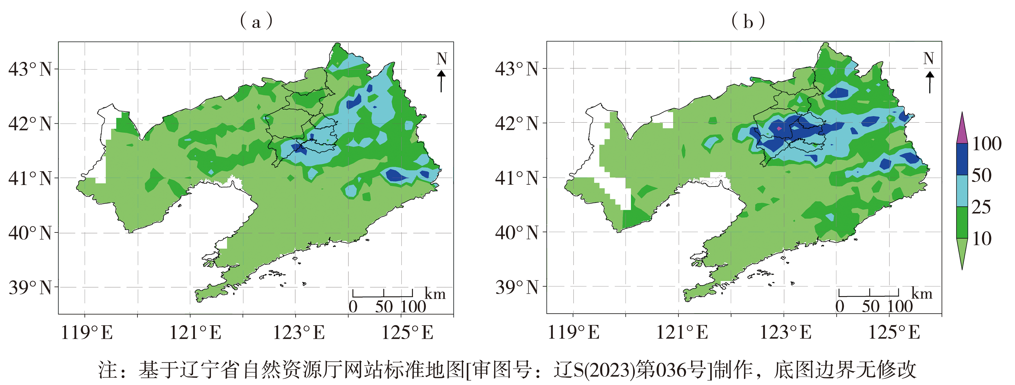
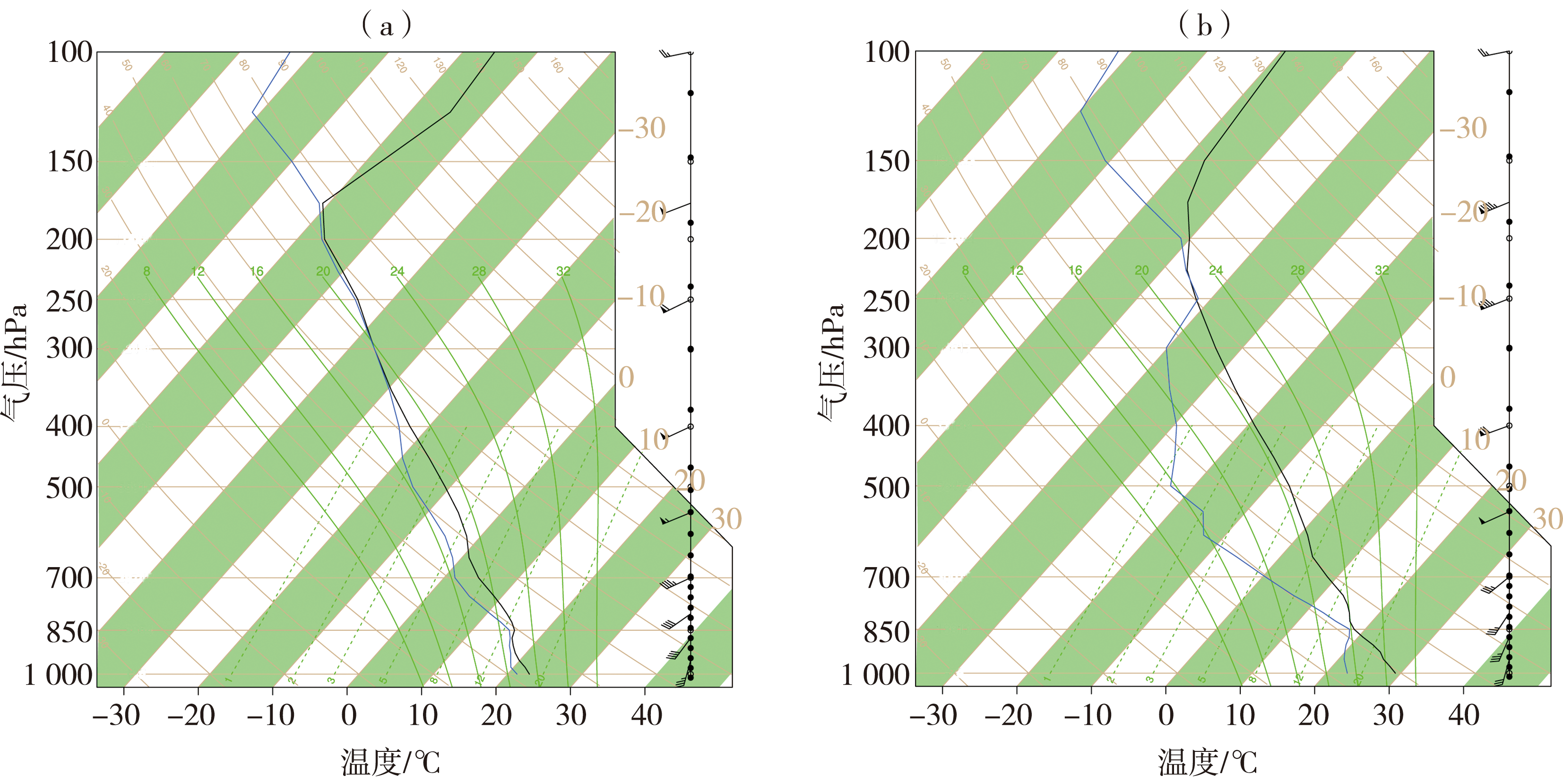
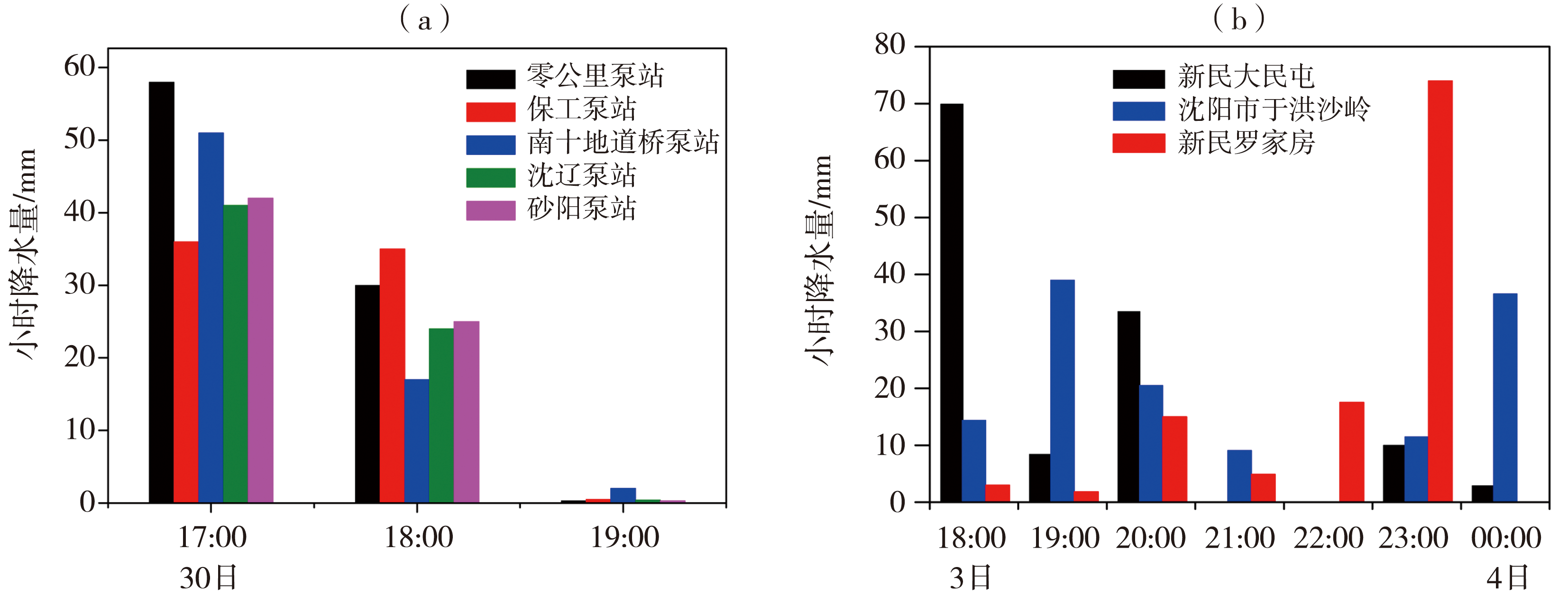
东北冷涡背景下的强对流天气具有局地性强、预报难度大的特点,冷空气的入侵往往对强对流天气的触发具有指示性意义。本文利用加密自动气象站地面观测数据、欧洲中期天气预报中心(European Center for Medium-Range Weather Forecasts,ECMWF)的ERA5(ECMWF Reanalysis v5)再分析资料及风廓线雷达资料,分析2016年6月30日和2020年8月3日2次冷涡强降水天气的形势及动力、热力特点,重点对比分析了2次过程的干侵入特征。这2次强降水过程地面均为蒙古气旋配合,从地面至高空动力条件较好。降水发生前,上午天空晴好,对流层中高层有冷空气渗透,近地层湿度大,形成上干冷、下暖湿的不稳定层结。强降水发生前,中层干区自西向东侵入,高层高位涡区向下伸展,增强对流不稳定发展,中层位涡接近1×10⁻⁶ m2·K·s-1·kg-1可以作为进入强降水时段的指标。干侵入指数呈偶极分布特征,可反映干冷空气和暖湿空气的相互作用,暴雨常发生在干侵入指数的密集带。当中高层干侵入指数正值区向中低层发展时,触发不稳定能量的释放,干侵入指数对强降水的落区及暴雨的增幅有较好的指示意义。

关键词: 冷涡, 强降水, 干侵入, 热动力特征

Abstract:

Severe convective weather under the Northeast Cold Vortex is characterized by strong locality and challenging predictability, with cold air incursions often serving as indicators for triggering such weather events. This study employs ground observations from densified automatic weather stations, ERA5 reanalysis data from ECMWF, and wind profile radar data to analyze the dynamics and thermodynamics of two heavy precipitation events under cold vortices background on June 30, 2016, and August 3, 2020. Both events were influenced by a Mongolian cyclone on the ground, creating favorable dynamic conditions from the surface up to higher altitudes. Before the precipitation, it was clear in the morning with cold air penetration at mid to high levels and high near-surface humidity, forming an unstable atmospheric layer with dry and cold air above and warm and moist air below. Before the heavy rainfall, a dry intrusion moved from west to east at mid-levels, and a downward extension of the upper-level high potential vorticity area enhanced convective instability. Mid-level potential vorticity nearing 1×10⁻⁶ m2·K·s-1·kg-1 can act as an indicator for the onset of heavy precipitation. The dry intrusion index, showing a dipole distribution, reflects the interaction between cold, dry and warm, moist air masses. Heavy rainfall often occurs within areas of dense dry intrusion indices. When positive values of the mid to upper layer dry intrusion index propagate to lower levels, they trigger the release of unstable energy. The dry intrusion index is indicative of heavy rainfall locations and the amplification of localized heavy rainfalls.

Key words: cold vortex, heavy precipitation, dry intrusion, thermodynamic characteristics

中图分类号: