干旱气象 ›› 2025, Vol. 43 ›› Issue (5): 799-809.DOI: 10.11755/j.issn.1006-7639-2025-05-0799

• 研究论文 • 上一篇    下一篇

FY-4A云覆盖率产品在宁夏的检验评估及订正

袁瑞瑞1,2,3(), 王坤1,2,3, 高睿娜1,2,4()   

  1. 1.中国气象局旱区特色农业气象灾害监测预警与风险管理重点实验室,宁夏 银川 750002
    2.宁夏气象防灾减灾重点实验室,宁夏 银川 750002
    3.宁夏气象服务中心,宁夏 银川 750002
    4.宁夏气候中心,宁夏 银川 750002
  • 收稿日期:2025-02-10 修回日期:2025-08-17 出版日期:2025-10-31 发布日期:2025-11-09
  • 通讯作者: 高睿娜(1988—),女,工程师,主要从事气候研究与应用工作。E-mail: 916476868@qq.com
  • 作者简介:袁瑞瑞(1996—),女,硕士,工程师,主要从事专业气象服务方面的研究。E-mail: yuanrr_818@163.com
  • 基金资助:
    宁夏回族自治区自然科学基金项目(2023AAC03793);宁夏智能数字预报技术研究与应用科技创新团队项目(2024CXTD006)

Evaluation and correction of FY-4A cloud cover fraction product in Ningxia

YUAN Ruirui1,2,3(), WANG Kun1,2,3, GAO Ruina1,2,4()   

  1. 1. Key Laboratory for Meteorological Disaster Monitoring and Early Warning and Risk Management of Characteristic Agriculture in Arid Regions, CMA, Yinchuan 750002, China
    2. Ningxia Key Lab oratory of Meteorological Disaster Prevention and Reduction, Yinchuan 750002, China
    3. Ningxia Meteorological Service Center, Yinchuan 750002, China
    4. Ningxia Climate Center, Yinchuan 750002, China
  • Received:2025-02-10 Revised:2025-08-17 Online:2025-10-31 Published:2025-11-09

摘要:

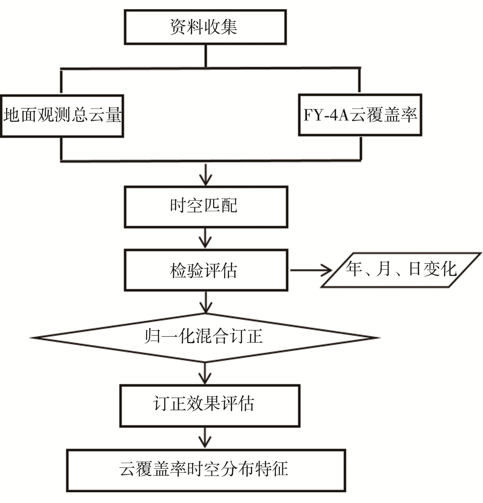
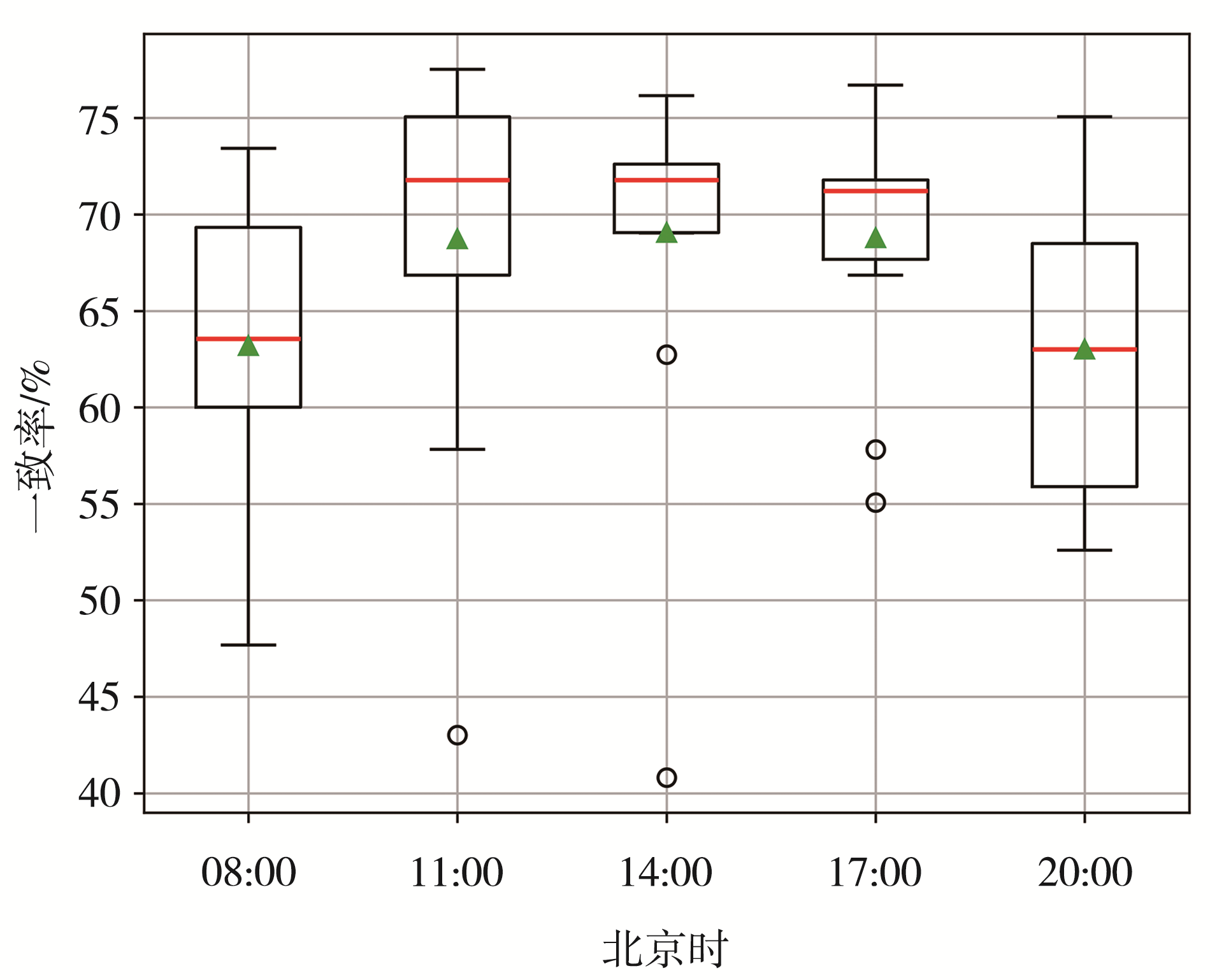
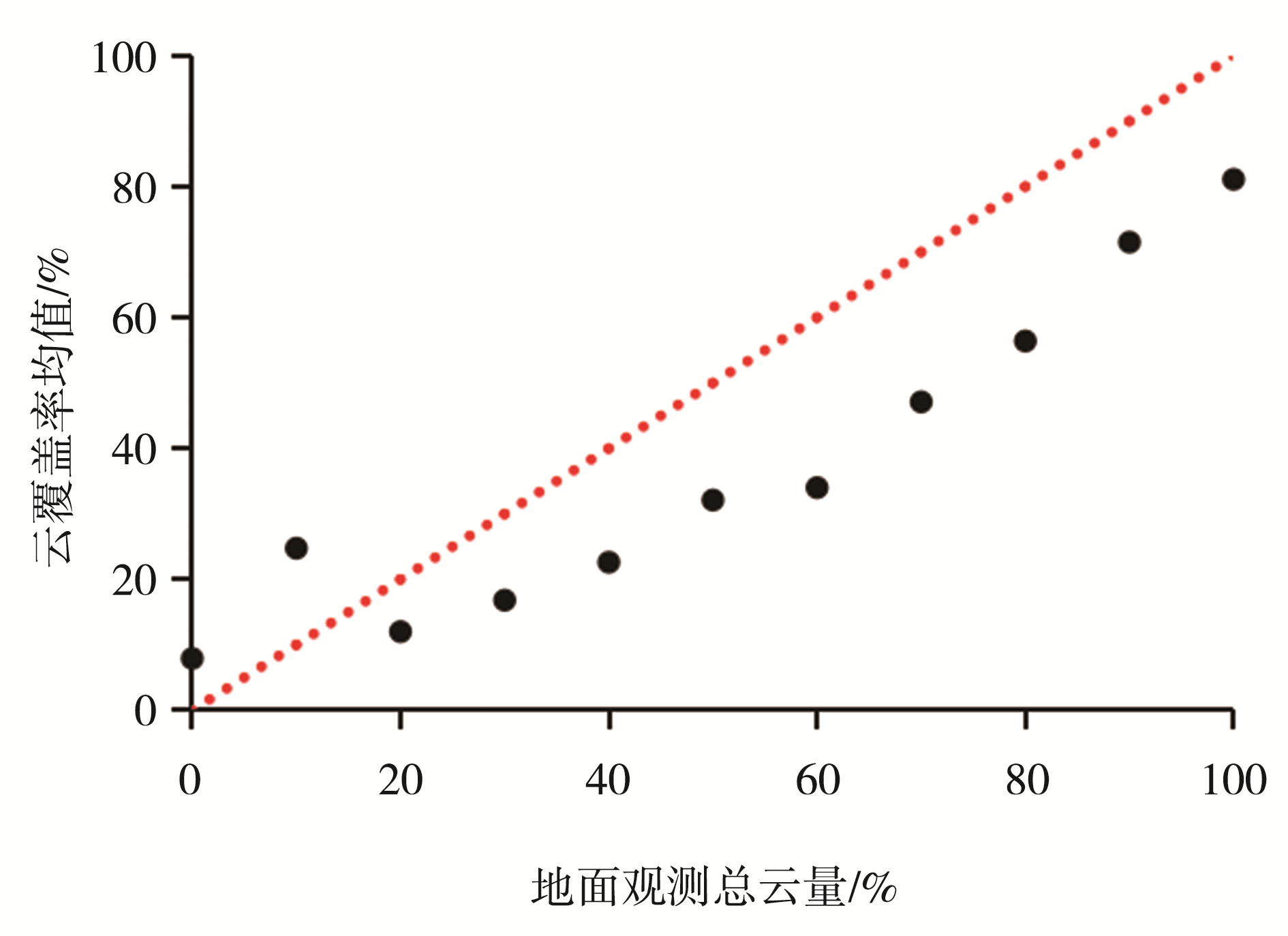
开展卫星反演云量的准确率评估是业务应用的基础,对于有效发挥卫星遥感高时空分辨率的优势以及弥补地面观测资料的不足具有重要意义。以处于典型干旱半干旱区域的宁夏为研究区,利用2019年08:00、11:00、14:00、17:00、20:00(北京时,下同)5个时次的地面观测总云量资料对风云四号A星(简称“FY-4A”)云覆盖率产品进行检验和评估,并利用归一化混合订正法对逐月云覆盖率产品进行订正,在此基础上分析宁夏日间云覆盖率的时空分布特征。结果表明:1)宁夏区域FY-4A云覆盖率产品与地面人工观测总云量的逐月、逐日变化趋势具有较高的一致性,全区平均及各气象站FY-4A云覆盖率与人工观测总云量的相关系数普遍为0.7~0.9,但总体上低于总云量值。2)从5个时次总云量和云覆盖率一致率来看,11:00、14:00、17:00的一致率高于08:00和20:00;从云量分级检验来看,一致率依次为晴天>阴天>少云>多云。3)归一化混合订正方法能有效降低FY-4A云覆盖率产品与地面人工观测总云量的偏差,订正后各月的平均值与气象站云量基本吻合。4)宁夏年平均日间云覆盖率为30%~70%,贺兰山沿山、引黄灌区(中卫市沙坡头区—银川一带)、中卫市海原县及固原市云覆盖率较高,石嘴山市惠农区、大武口区东部、平罗县东部云覆盖率最低;5—6月全区云覆盖率普遍较高,12月云覆盖率最低。

关键词: FY-4A云覆盖率产品, 检验评估, 订正, 时空分布

Abstract:

The accuracy evaluation of satellite-derived cloud cover is foundation of operational applications, and it is of great significance for effectively leveraging the high spatiotemporal resolution advantages of satellite remote sensing and compensating for the scarcity of ground-based observations. This study focuses on the Ningxia region, a typical arid and semiarid region, and utilizes ground observations of total cloud cover amount at five time points (08:00, 11:00, 14:00, 17:00, and 20:00, Beijing time, the same below) in 2019 to validate and evaluate the Fengyun-4A ( referred to as “FY-4A”) satellite cloud cover fraction product, then uses the normalized mixed correction method to correct the monthly cloud cover fraction products and analyze the daytime spatiotemporal distribution characteristics of cloud cover fraction in Ningxia. The results indicate that: 1) The monthly and daily variation trends of the FY-4A cloud cover fraction product in Ningxia region are highly consistent with those of ground manual observations of total cloud amount. The correlation coefficients between FY-4A satellite-derived cloud cover fraction and ground observed total cloud amount range from 0.7 to 0.9 across the whole region and at individual meteorological stations, but the derived cloud cover fractions are generally lower than the observed total cloud amounts. 2) In terms of the consistency rate between the total cloud amount and cloud cover fraction at five different times of a day, the consistency rates at 11:00, 14:00, and 17:00 are higher than those at 08:00 and 20:00. For cloud cover categories test, the consistency rates are in the order of clear sky > overcast > partly cloudy > mostly cloudy. 3) The normalized mixed correction method effectively reduces the bias between the FY-4A cloud cover fraction product and the manual total cloud amount observations. After correction, the monthly average values of the cloud cover fraction product are in good agreement with the cloud amounts observed at meteorological stations. 4) The annual average daytime cloud coverage in Ningxia ranges from 30% to 70%. Higher cloud cover fractions are found along the Helan Mountains, in the Yellow River irrigation area (from Shapotou District, Zhongwei, to Yinchuan), and in Haiyuan County and Guyuan City. The lowest cloud cover occurs in the eastern parts of Huinong District, Dawukou District, and Pingluo County in Shizuishan City. Cloud cover fraction is generally higher in May and June, and lowest in December.

Key words: FY-4A cloud cover fraction products, validation and evaluation, correction, spatiotemporal distribution

中图分类号: