基于新型观测资料的徒骇-马颊河流域“8·26”极端降水过程分析
|
|
高雷娜, 翟亮, 张琳, 王忠石, 韩亚静, 焦洋
|
Analysis of the“8·26”extreme precipitation event in the Tuhai-Majia River Basin based on new observational data
|
|
GAO Leina, ZHAI Liang, ZHANG Lin, WANG Zhongshi, HAN Yajing, JIAO Yang
|
|
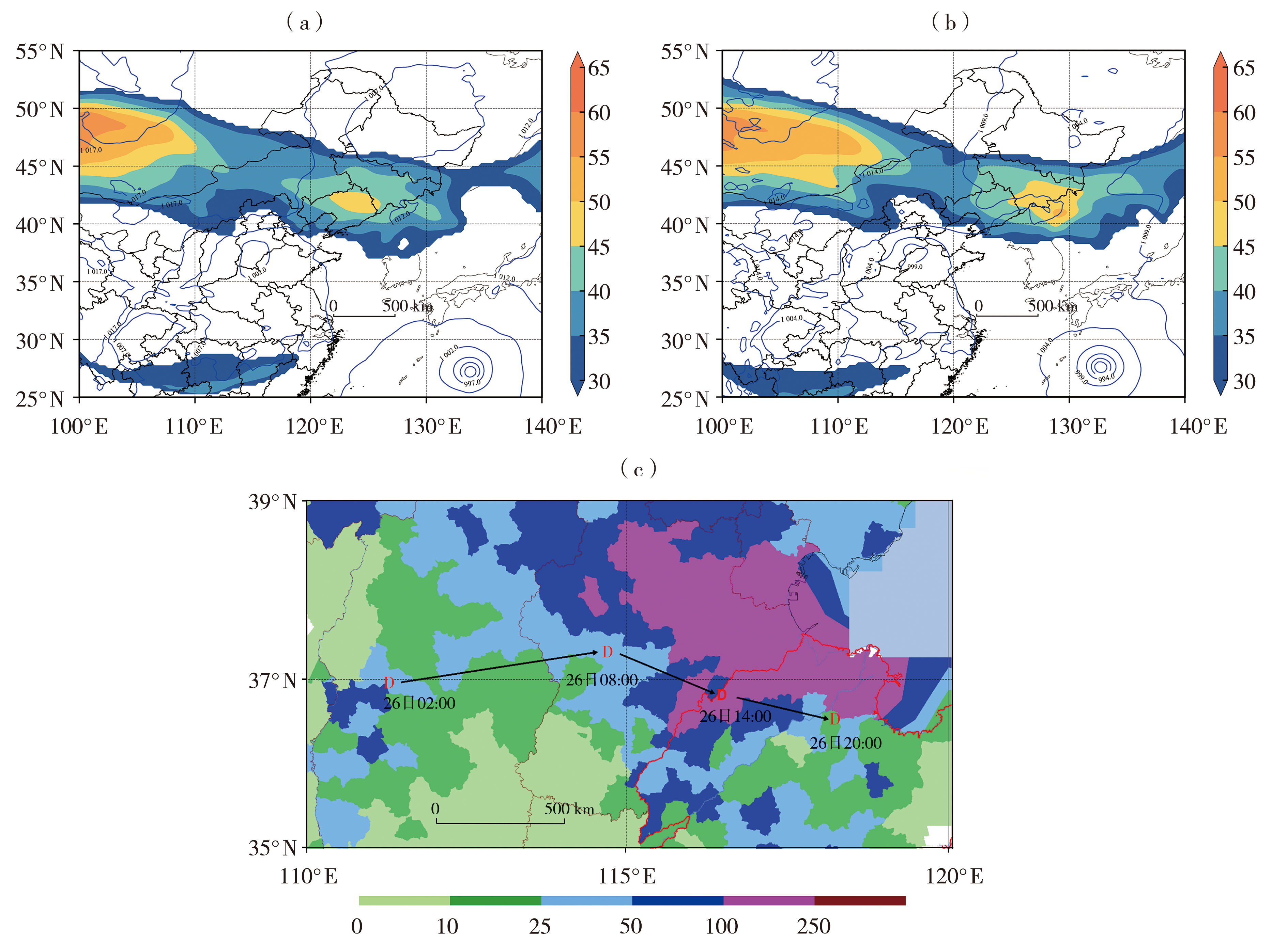
图4 2024年8月26日08:00(a)、14:00(b)地面气压场(蓝色线,间隔为5.0,单位:hPa)与200 hPa风场(填色,单位:m·s-1)叠加及气旋移动路径(c)
(红色字母D为低涡中心,黑色箭头为移动路径,填色为26日20:00 24 h降水量,单位:mm)
|
Fig.4 Superimposed plots of surface pressure field (blue lines, the interval is 5.0, Unit: hPa) and 200 hPa wind field (the color shaded, Unit: m·s-1) at 08:00 (a) and 14:00 (b), and the cyclone moving track (c) on 26 August 2024
(The red letter D indicates the low vortex center, the black arrows represent the moving track, the color shaded depicts the 24-hour accumulated precipitation at 20:00 on 26 August, Unit: mm)
|
|
|
|
|