基于风云四号卫星与随机森林的内蒙古地区云物理特性参量反演及应用
Retrieval and application of cloud physical property parameters in Inner Mongolia based on Fengyun-4 Satellite and random forest
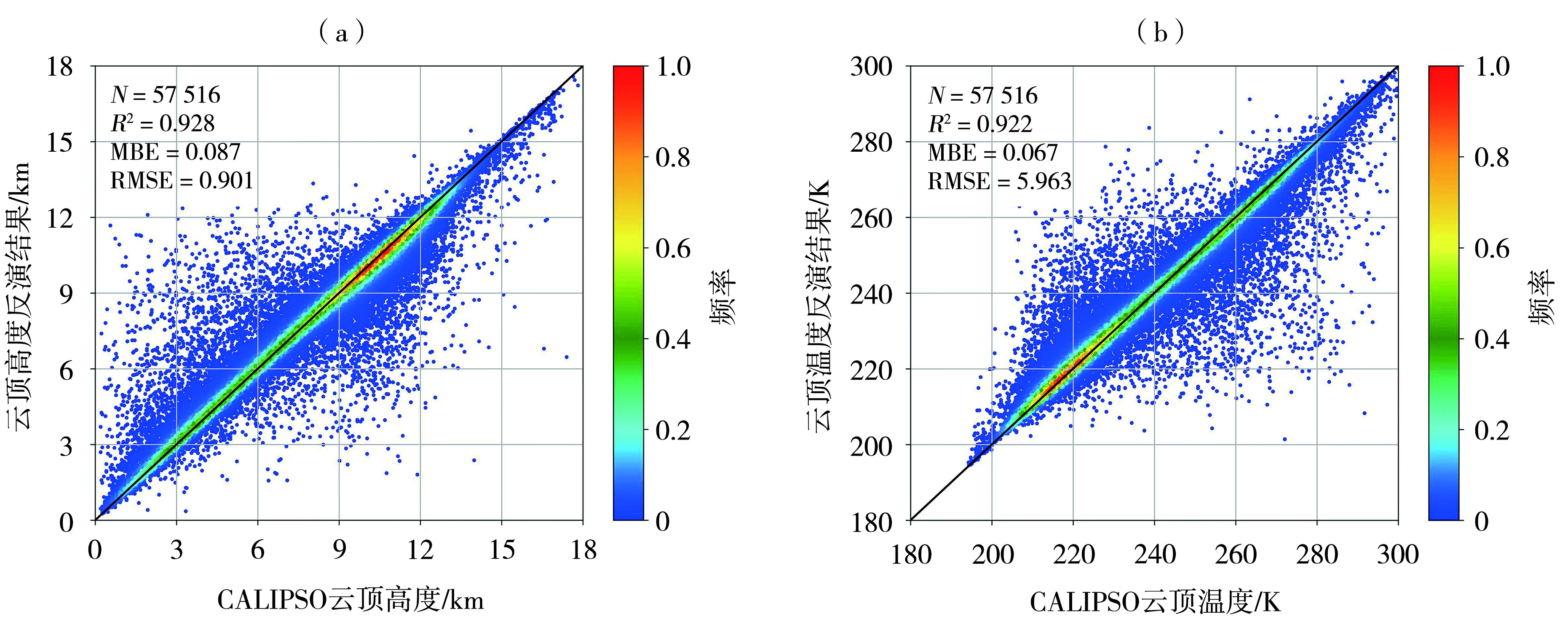
(频率表示样本点出现的概率密度,反映数据分布的集中程度)
(Frequency represents the probability density of sample points occurring, reflecting the degree of concentration of data distribution)