天山峡谷北缘一次极端下坡风暴三维结构及触发机理分析
|
|
汤浩, 周雅蔓, 安大维, 王敏仲
|
Analysis of the three-dimension structure and triggering mechanism of a severe downslope windstorm case in north edge of Tianshan canyon
|
|
TANG Hao, ZHOU Yaman, AN Dawei, WANG Minzhong
|
|
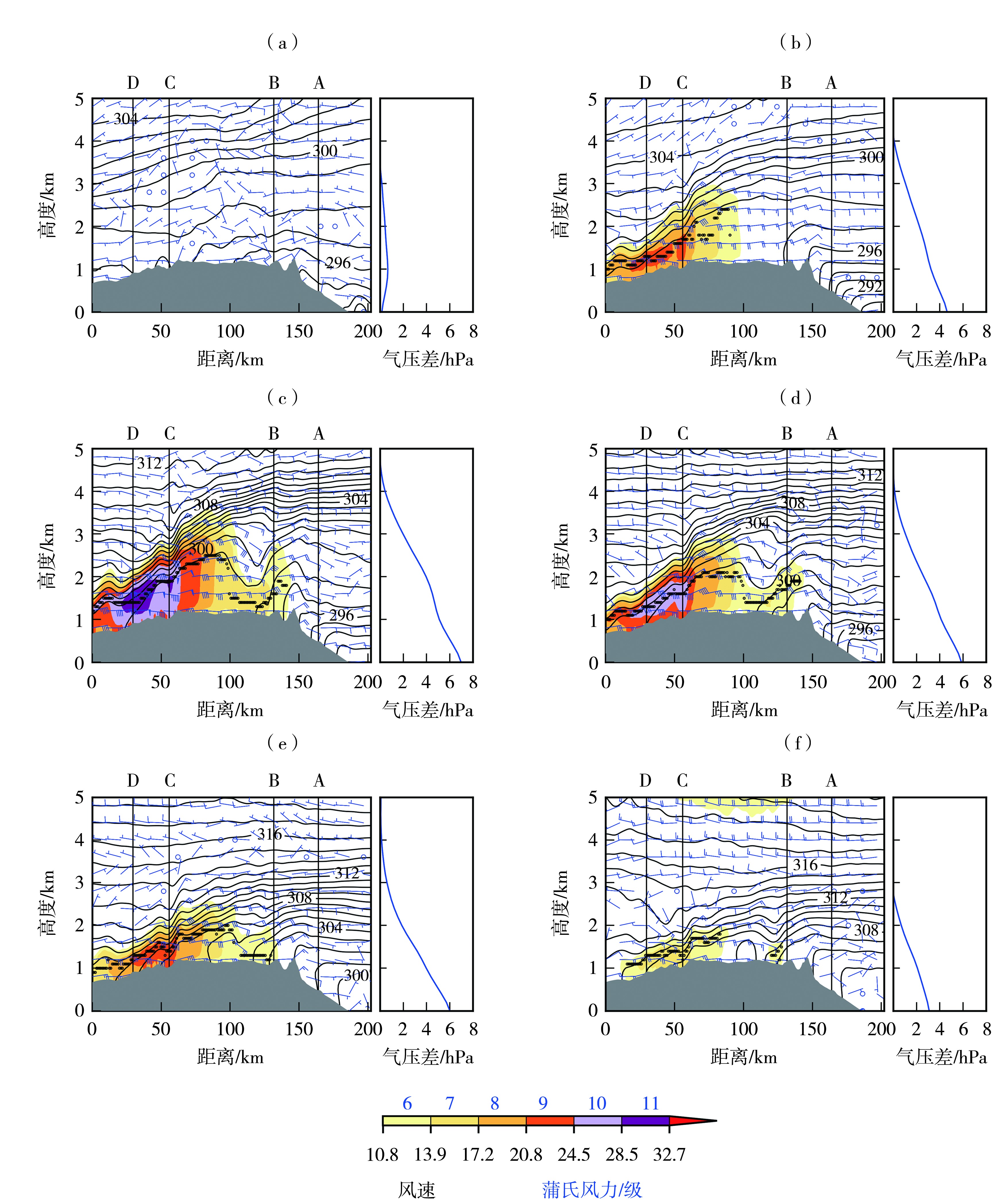
图8 2022年4月29日22:00(a)、30日11:00(b)、5月1日11:00(c)、2日11:00(d)、3日13:00(e)及20:00(f)沿气流穿越天山峡谷剖面的水平风速(填色,单位:m·s-1)、位温(等值线,单位:K)、水平风速与垂直运动合成(风矢,单位:m·s-1)随高度的变化及吐鲁番和乌鲁木齐气压差廓线
(黑色圆点为地面至5 km高度大于12 m·s-1的最大风速层位置,下同)
|
Fig.8 The variations of horizontal wind speed (the color shaded, Unit: m·s-1), potential temperature (contour lines, Unit: K), and the combined horizontal wind speed and vertical motion (arrow vectors, Unit: m·s-1) with height along the airflow passing through the Tianshan canyon together with the pressure difference profile between Turpan and Urumqi at 22:00 on 29 April (a), 11:00 on 30 April (b), 11:00 on 1 May (c), 11:00 on 2 May (d), 13:00 on 3 May (e), and 20:00 on 3 May (f) 2022
(Black dots indicate the height of the maximum wind speed layer exceeding 12 m·s-1 from the surface to 5 km, the same as below)
|
|
|
|
|