京津冀地区一次极端暖区暴雨成因分析
Causes analysis of an extreme warm-sector rainstorm in Beijing-Tianjin-Hebei region
京津冀地区一次极端暖区暴雨成因分析 |
| 董琪如, 王莹, 李英华, 杨旭, 梁康壮 |
|
Causes analysis of an extreme warm-sector rainstorm in Beijing-Tianjin-Hebei region |
| DONG Qiru, WANG Ying, LI Yinghua, YANG Xu, LIANG Kangzhuang |
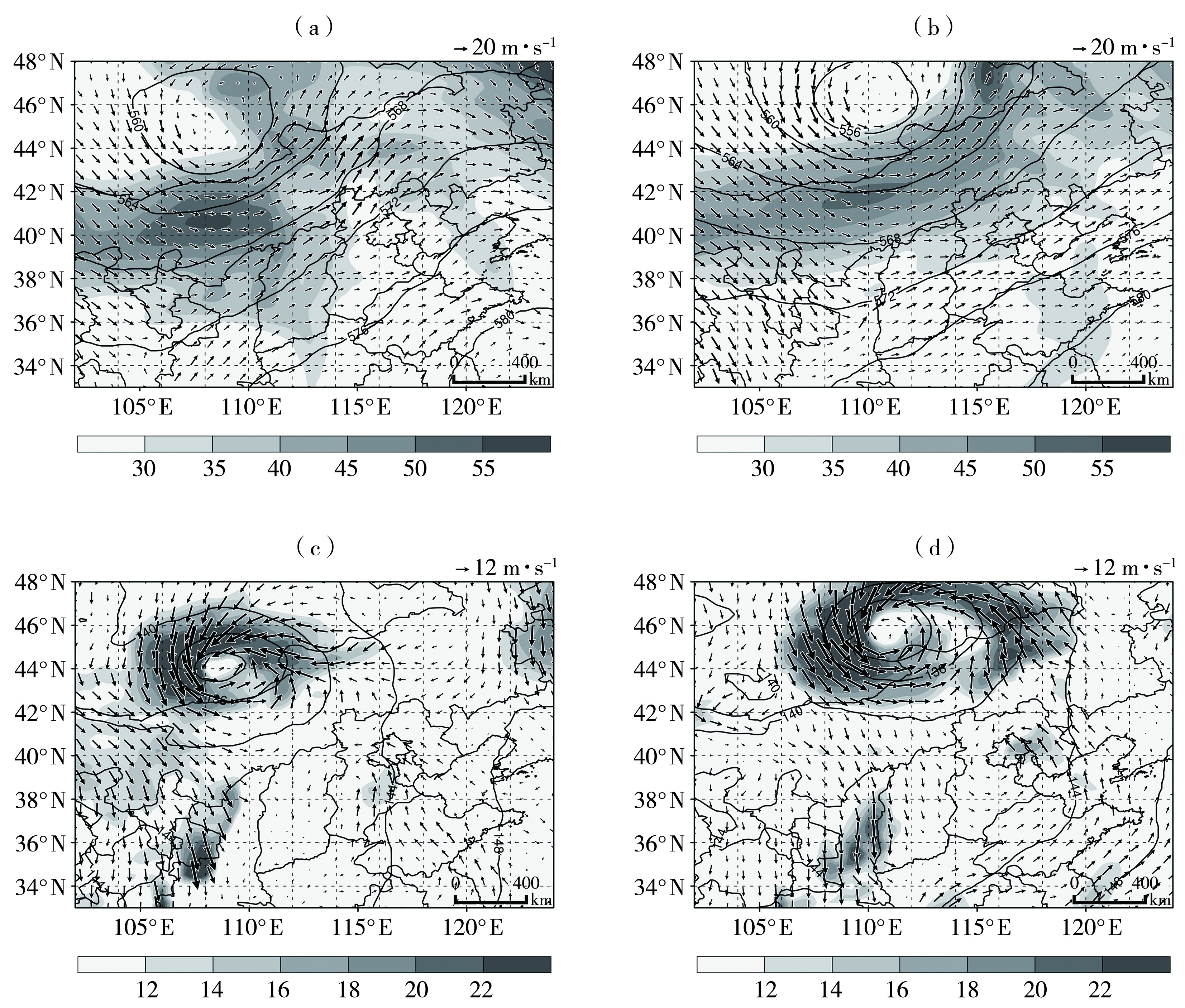
| 图3 2020年8月12日06:00(a、c)和15:00(b、d)500 hPa位势高度(实线,单位:dagpm)、风场(箭矢,单位:m·s-1)和200 hPa高空急流(阴影,单位:m·s-1)(a、b),以及850 hPa位势高度(等值线,单位:dagpm)、风场(箭矢,单位:m·s-1)和低空急流(阴影,单位:m·s-1)(c、d) |
| Fig.3 The 500 hPa geopotential height (contour lines,Unit: dagpm),wind field (arrow vectors,Unit: m·s-1) and 200 hPa high-level jet (the shaded,Unit: m·s-1)(a,b),and 850 hPa geopotential height (contour lines,Unit: dagpm),wind field (arrow vectors,Unit: m·s-1),and low-level jet ( the shaded,Unit: m·s-1)(c,d) at 06:00 (a,c) and 15:00 (b,d) August 12,2020 |
|
|