2025年1月美国洛杉矶破纪录山火事件的干旱气象条件归因
Attribution of drought-related meteorological conditions for the record-breaking wildfire event in Los Angeles in January 2025
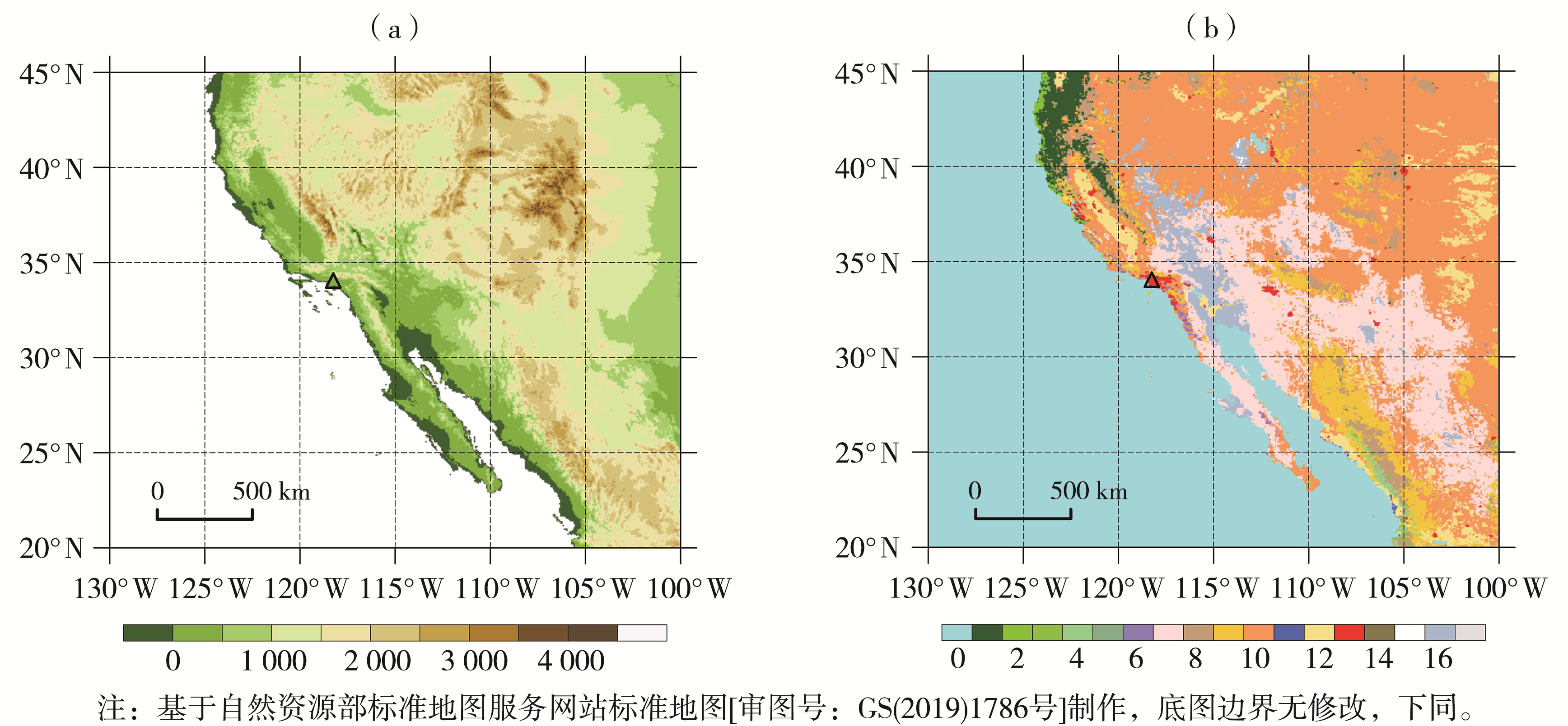
(三角符号表示洛杉矶位置,下同;b图中数字表示IGBP植被覆盖类型依次为:0 水,1 常绿针叶林,2 常绿阔叶林,3 落叶针叶林,4 落叶阔叶林,5 混交林,6 郁闭灌丛,7 开放灌丛,8 多树草原,9 稀树草原,10 草原,11 永久湿地,12 作物,13 城市和建成区,14 作物和自然植被的镶嵌体,15 雪、冰,16 裸地或低植被覆盖地,17 未分类区)
(The triangles denote the location of Los Angeles, the same as below ; The numbers for IGBP vegetation types in fig. b are as follows: 0 denotes water, 1 evergreen needleleaf forest, 2 evergreen broadleaf forest, 3 deciduous needleleaf forest, 4 deciduous broadleaf forest, 5 mixed forest, 6 closed shrubland, 7 open shrublands, 8 woody savannas, 9 savannas, 10 grasslands, 11 permanent wetlands, 12 croplands, 13 urban and built_up, 14 cropland natural vegetation mosaic, 15 snow and ice, 16 barren or sparsely vegetated, and 17 unclassified)