辽东半岛一次大暴雨过程触发和维持机制分析
|
|
梁军, 贾旭轩, 张胜军, 冯呈呈, 李婷婷, 程航, 刘晓初
|
Diagnostic analysis of trigger and maintenance mechanism associated with a rainstorm over Liaodong Peninsula
|
|
LIANG Jun, JIA Xuxuan, ZHANG Shengjun, FENG Chengcheng, LI Tingting, CHENG Hang, LIU Xiaochu
|
|
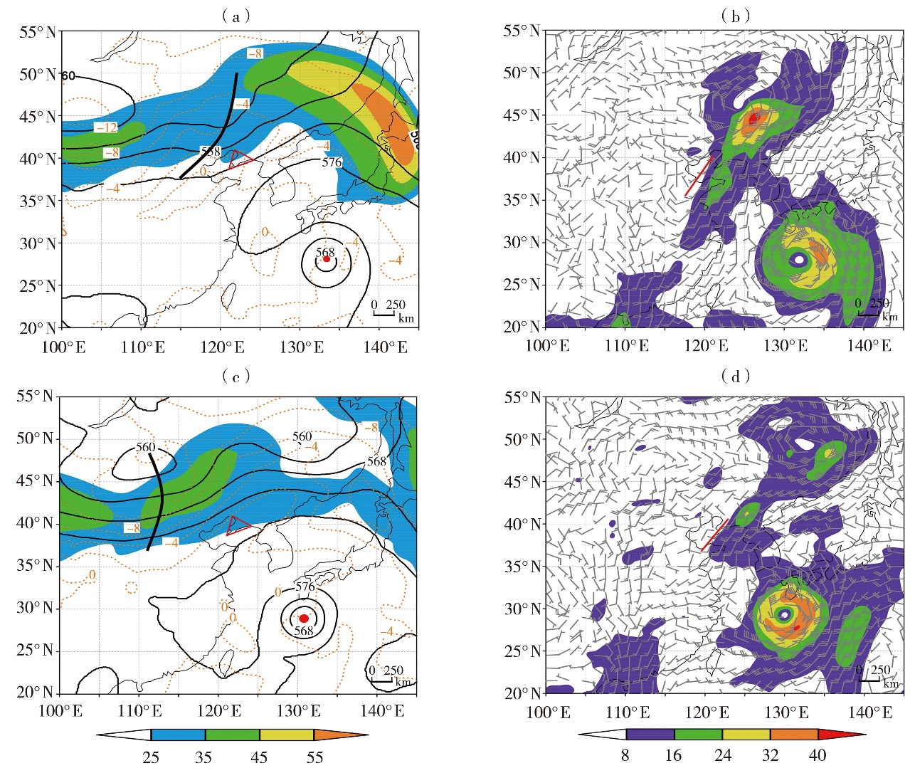
图3 2017年8月3日20:00(a)与4日20:00(c)500 hPa高度场(黑实线,单位:dagpm)、温度场(红色虚线,单位:℃)及200 hPa水平全风速(填色,单位:m·s-1),4日02:00(b)和5日02:00(d)850 hPa风场(风矢,单位:m·s-1)及水汽通量(填色,单位:g· cm-1·hPa-1· s-1)
(红色实心圆点为“奥鹿”台风位置,黑色粗实线为槽线,红色实线为切变线;三角形区域为辽东半岛地区,下同)
|
Fig.3 The 500 hPa height fields (black solid lines, Unit: dagpm) and temperature fields (red dashed lines, Unit: ℃), 200 hPa wind speed (the color shaded, Unit: m·s-1)at 20:00 on 3(a)and 20:00 on 4(c)August 2017;the 850 hPa wind fields (wind vectors, Unit: m·s-1) and water vapor flux fields (the color shaded, Unit: g·cm-1·hPa-1·s-1) at 02:00 on 4 (b) and 02:00 on 5 (d) August 2017
(The red solid dot indicates the TC centers of Noru, the black thick solid line is upper-level trough, the solid red line is the shear line; the red triangle shows Liaodong Peninsula, the same as below)
|
|
|
|
|