夏季青藏高原及周边地区大气热源与川渝盆地高温日数年际变化的关系
|
|
黄小梅, 周长艳, 庞轶舒, 于浩慧, 甘薇薇
|
Relationship between atmospheric heat source over the Qinghai-Xizang Plateau and its surrounding area and annual variation of high temperature days in Summer in Sichuan-Chongqing Basin
|
|
HUANG Xiaomei, ZHOU Changyan, PANG Yishu, YU Haohui, GAN Weiwei
|
|
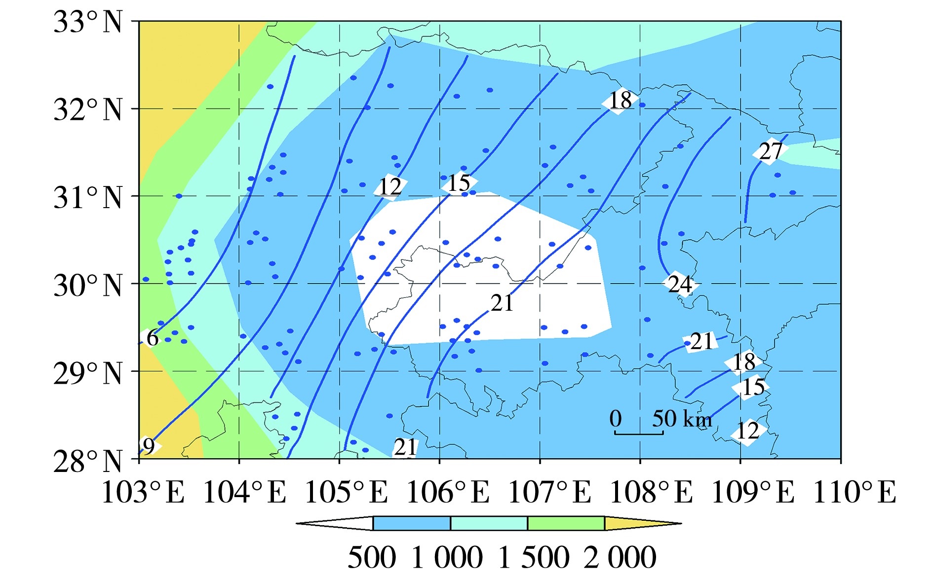
图1 川渝盆地地形高度(填色,单位:m)和1991—2020年气候平均的夏季高温日数(等值线,单位:d)空间分布
(圆点表示气象站点)
注:基于国家测绘地理信息局标准地图服务网站下载的审图号为GS(2019)1822号的标准地图制作,底图边界无修改,下同。
|
Fig.1 The spatial distribution of topographic height (the color shaded, Unit: m), and the climatological mean high temperature days (isolines, Unit: d) in summer from 1991 to 2020 in the Sichuan-Chongqing Basin
(The dots represent the meteorological stations)
|
|
|
|
|