不同边界层参数化方案对台风“烟花”北上阶段暴雨模拟的影响试验
Effect of different boundary layer parameterization schemes on simulation of the heavy rainfall during Typhoon In-Fa(2106) moving northward period
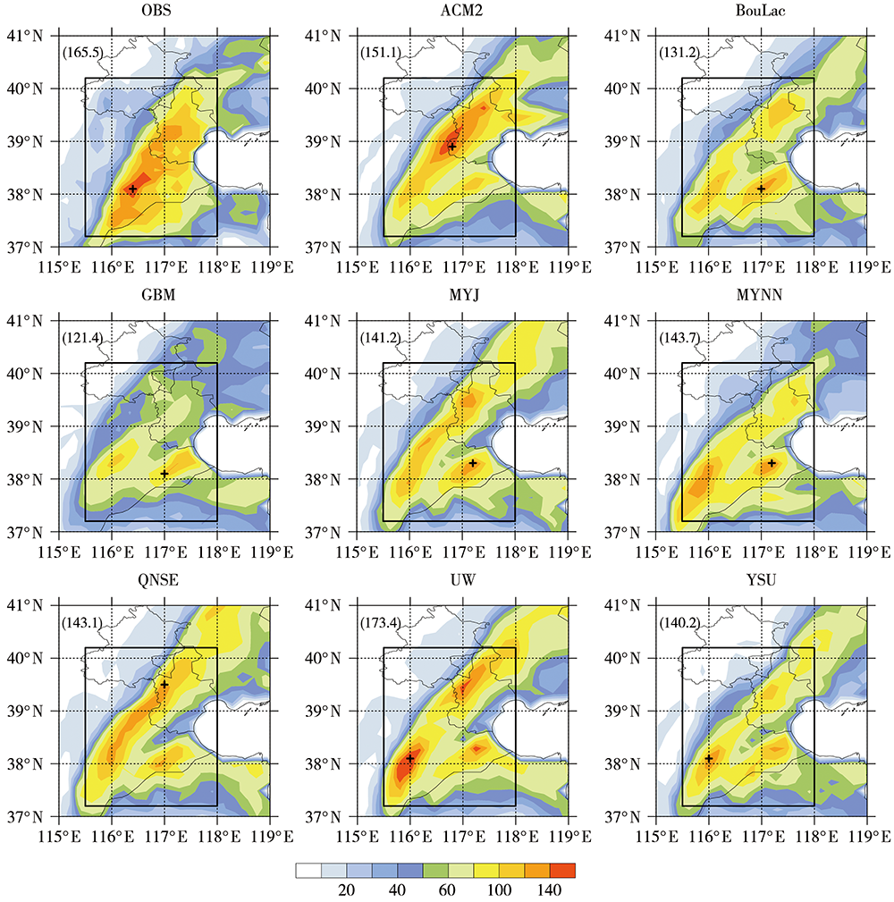
[左上角括号中数字为24 h最大累积降水量,黑色十字代表最大降水量出现位置,黑色方框(115.5°E—118°E,37.2°N—40.2°N)为主要降水区]
(The number on the upper left brackets denotes the maximum 24 h accumulated precipitation, the black cross denotes the location of maximum rainfall, and the black rectangle (115.5°E—118°E, 37.2°N—40.2°N) denotes the main precipitation area)