), 赵强1,2(), 刘慧1, 彭力3
), ZHAO Qiang1,2(), LIU Hui1, PENG Li3
), 赵强1,2(), 刘慧1, 彭力3
), ZHAO Qiang1,2(), LIU Hui1, PENG Li3
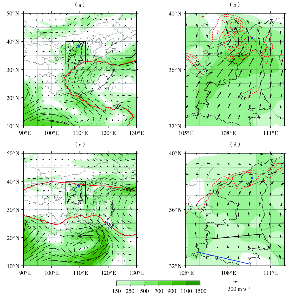
图5. 2022年7月11日08:00(a、b)、8月9日02:00(c、d)地面至300 hPa的水汽通量(箭矢及彩色填色区,单位:kg·m-1·s-1,仅显示大于100 kg·m-1·s-1的值)(a、c)及其散度(等值线,单位:10-4 kg·m-2·s-1)(b、d)
[
Fig.5. The vertically integrated water vapor fluxes from ground to 300 hPa (arrow vector and color shaded area, Unit: kg·m-1·s-1, only plotting the value greater than 100 kg·m-1·s-1) (a, c) and its divergence (isoline,Unit:10-4 kg·m-2·s-1) (b, d) at 08:00 BST 11 July (a, b) and 02:00 BST 9 August (c, d) 2022
(The box in