应用FY卫星产品分析陇东半干旱区特大暴雨事件云特征
李晨蕊1( ), 伏晶1(), 刘维成1, 王基鑫1, 王一丞1, 傅朝1, 郑新2
), 伏晶1(), 刘维成1, 王基鑫1, 王一丞1, 傅朝1, 郑新2
Cloud characteristics analysis of a torrential rainfall event use FY satellite in semi-arid region of Eastern Gansu Province
LI Chenrui1(), FU Jing1(), LIU Weicheng1, WANG Jixin1, WANG Yicheng1, FU Zhao1, ZHEN Xin2
), FU Jing1(), LIU Weicheng1, WANG Jixin1, WANG Yicheng1, FU Zhao1, ZHEN Xin2
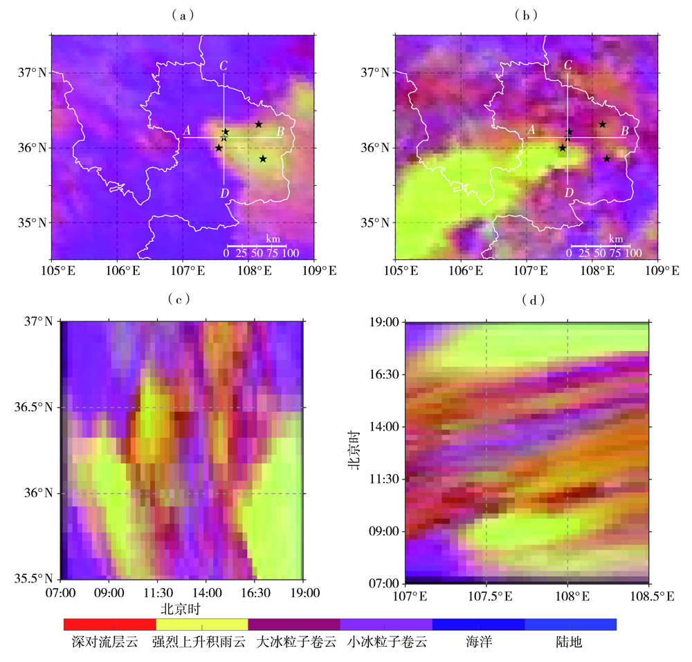
图7. 2022年7月15日08:00(a)、16:00(b)FY-4B卫星白天强风暴图像及沿翟家河站(107.62°E,36.08°N)的纬度-时间(c,沿CD线段)和经度-时间(d,沿AB线段)剖面
Fig.7. The storm image on daytime from FY-4B satellite at 08:00 BST (a) and 16:00 BST (b) on 15 July 2022,and the latitude-time (c, along CD line segment) and longitude-time (d, along AB line segment) cross section along Zhaijiahe station (107.62°E,36.08°N)