应用FY卫星产品分析陇东半干旱区特大暴雨事件云特征
李晨蕊1( ), 伏晶1(), 刘维成1, 王基鑫1, 王一丞1, 傅朝1, 郑新2
), 伏晶1(), 刘维成1, 王基鑫1, 王一丞1, 傅朝1, 郑新2
Cloud characteristics analysis of a torrential rainfall event use FY satellite in semi-arid region of Eastern Gansu Province
LI Chenrui1(), FU Jing1(), LIU Weicheng1, WANG Jixin1, WANG Yicheng1, FU Zhao1, ZHEN Xin2
), FU Jing1(), LIU Weicheng1, WANG Jixin1, WANG Yicheng1, FU Zhao1, ZHEN Xin2
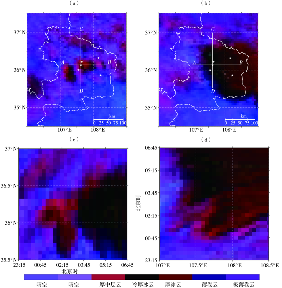
图6. 2022年7月15日01:00(a)、05:00(b)FY-4B卫星夜间微物理图像及沿翟家河站(107.62°E,36.08°N)的纬度-时间(c,沿CD线段)和经度-时间(d,沿AB线段)剖面
(白色五角星为5个区域站地理位置)
Fig.6. The microphysical image at nighttime from FY-4B satellite at 01:00 BST (a) and 05:00 BST (b) on 15 July 2022, and the latitude-time (c, along CD line segment) and longitude-time (d, along AB line segment) cross section along Zhaijiahe station (107.62°E, 36.08°N)
(The white pentagram for 5 regional stations geography location)