应用FY卫星产品分析陇东半干旱区特大暴雨事件云特征
李晨蕊1( ), 伏晶1(), 刘维成1, 王基鑫1, 王一丞1, 傅朝1, 郑新2
), 伏晶1(), 刘维成1, 王基鑫1, 王一丞1, 傅朝1, 郑新2
Cloud characteristics analysis of a torrential rainfall event use FY satellite in semi-arid region of Eastern Gansu Province
LI Chenrui1(), FU Jing1(), LIU Weicheng1, WANG Jixin1, WANG Yicheng1, FU Zhao1, ZHEN Xin2
), FU Jing1(), LIU Weicheng1, WANG Jixin1, WANG Yicheng1, FU Zhao1, ZHEN Xin2
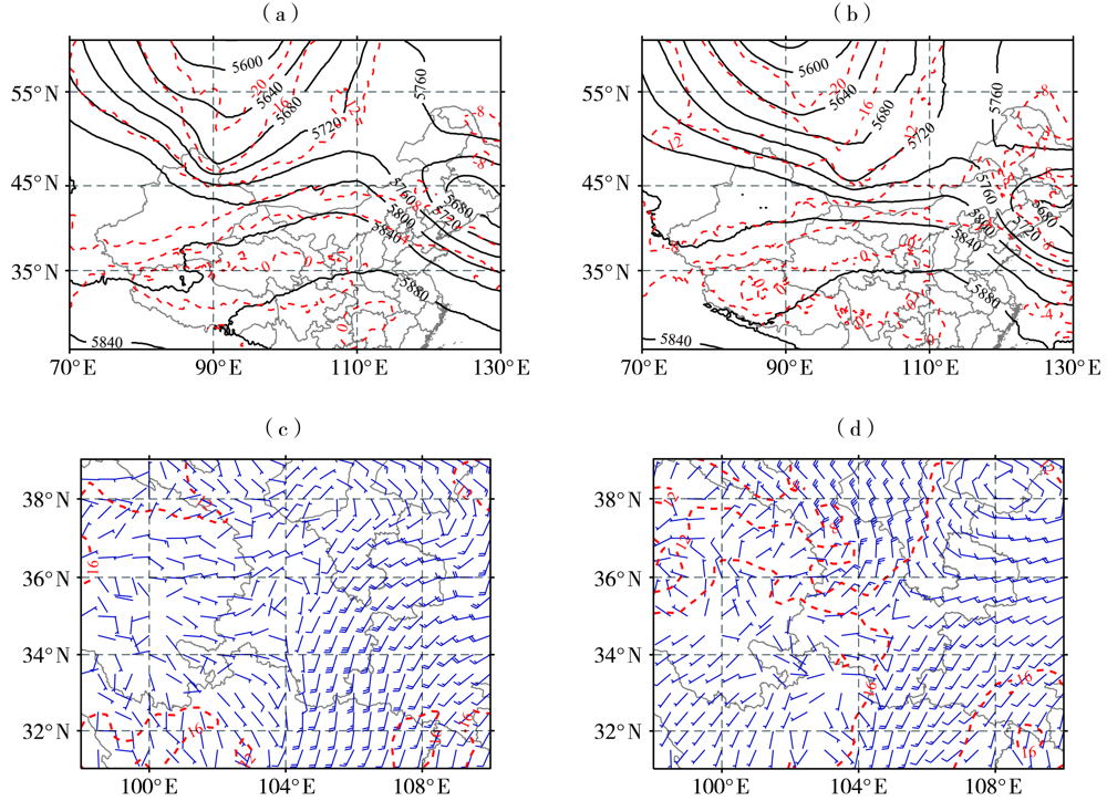
图2. 2022年7月15日02:00(a、c)、14:00(b、d)500 hPa位势高度场(黑色等值线,单位:gpm)及温度场(红色等值线,单位:℃)(a、b),700 hPa风场(风矢量,单位:m·s-1)及温度场(红色等值线,单位:℃)(c、d)
Fig.2. The geopotential height field (black isolines, Unit: gpm) and temperature field (red isolines, Unit: ℃) at 500 hPa(a, b),wind field (wind vectors, Unit: m·s-1) and temperature field (red isolines, Unit: ℃) at 700 hPa (c, d) at 02:00 BST (a, c) and 14:00 BST (b, d) on 15 July 2022