), 曹彦超1, 刘维成2(), 徐丽丽2, 张洪芬1, 孙子茱1
), CAO Yanchao1, LIU Weicheng2(), XU Lili2, ZHANG Hongfen1, SUN Zizhu1
), 曹彦超1, 刘维成2(), 徐丽丽2, 张洪芬1, 孙子茱1
), CAO Yanchao1, LIU Weicheng2(), XU Lili2, ZHANG Hongfen1, SUN Zizhu1
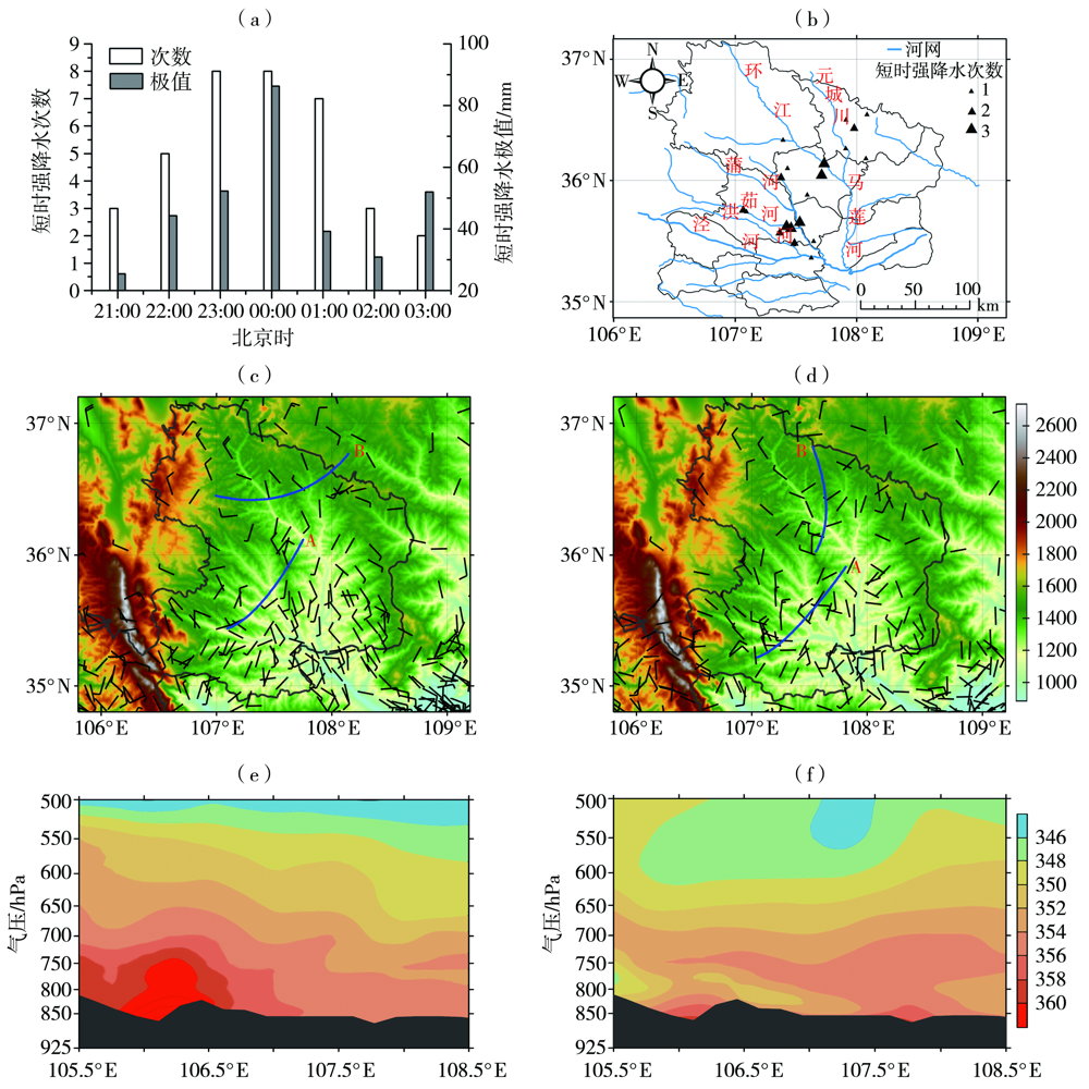
图7. 2021年8月18—19日极端强降水期间短时强降水次数和雨量极值逐时变化(a)、次数空间分布(b)和18日21:00(c)、19日03:00(d)地面风场(风矢,单位:m·s-1)及辐合线(蓝色线)(彩色填充区为海拔高度,单位:m)以及18日16:00(e)、19日00:00(f)沿35.6°N的假相当位温(彩色填充区,单位:K)纬向垂直剖面(黑色阴影为地形)
Fig.7. The hourly evolutions of times and precipitation extremum (a) and the spatial distribution of times (b) of short-term heavy rainfall during the extremely strong precipitation process from 18 to 19 August, the surface wind field (wind vectors, Unit: m·s-1) and convergence lines (blue lines)(the color shaded for elevation, Unit: m) at 21:00 BST 18 August (c) and 03:00 BST 19 August (d), and the zonal vertical section of pseudo-equivalent potential temperature (the color shaded, Unit: K)(the black shaded for terrain) along 35.6°N at 16:00 BST 18 August (e) and 00:00 BST 19 August (f) 2021