不同雷达观测资料同化对一次罕见飑线天气模拟的影响
Impact of different radar data assimilation on a rare strong squall line simulation
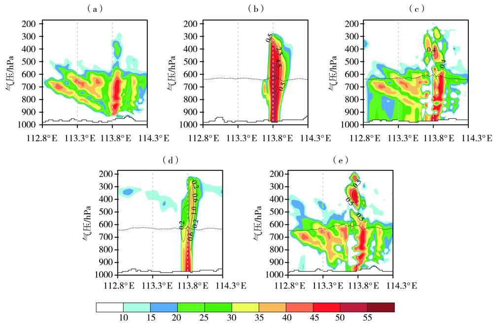
(a)观测,(b)NODA,(c)DARF,(d)DAVE,(e)DARV
(a) observation, (b) NODA, (c) DARF, (d) DAVE, (e) DARV
不同雷达观测资料同化对一次罕见飑线天气模拟的影响 |
| 曹倩, 雷桂莲, 易艳红, 章毅之, 刘良玉, 彭王敏子 |
|
Impact of different radar data assimilation on a rare strong squall line simulation |
| CAO Qian, LEI Guilian, YI Yanhong, ZHANG Yizhi, LIU Liangyu, PENG Wangminzi |
| 图6 2018年3月4日13:00观测和各试验初始分析场的雷达反射率(填色区,单位:dBZ)、霰混合比(黑色等值线,单位:g·kg-1)沿 (a)观测,(b)NODA,(c)DARF,(d)DAVE,(e)DARV |
| Fig.6 Vertical cross sections of radar composite reflectivity (color shaded, Unit:dBZ) and graupel mixing ratio (black contours, Unit:g·kg-1) of observation and initial analysis fields of different experiments along the blue line in (a) observation, (b) NODA, (c) DARF, (d) DAVE, (e) DARV |
|
|