六盘山区一次典型暴雨过程的地形敏感性模拟试验
|
|
马思敏, 穆建华, 舒志亮, 孙艳桥, 邓佩云, 周楠
|
Topography sensitivity simulation test of a typical rainstorm process in Liupan Mountain region
|
|
MA Simin, MU Jianhua, SHU Zhiliang, SUN Yanqiao, DENG Peiyun, ZHOU Nan
|
|
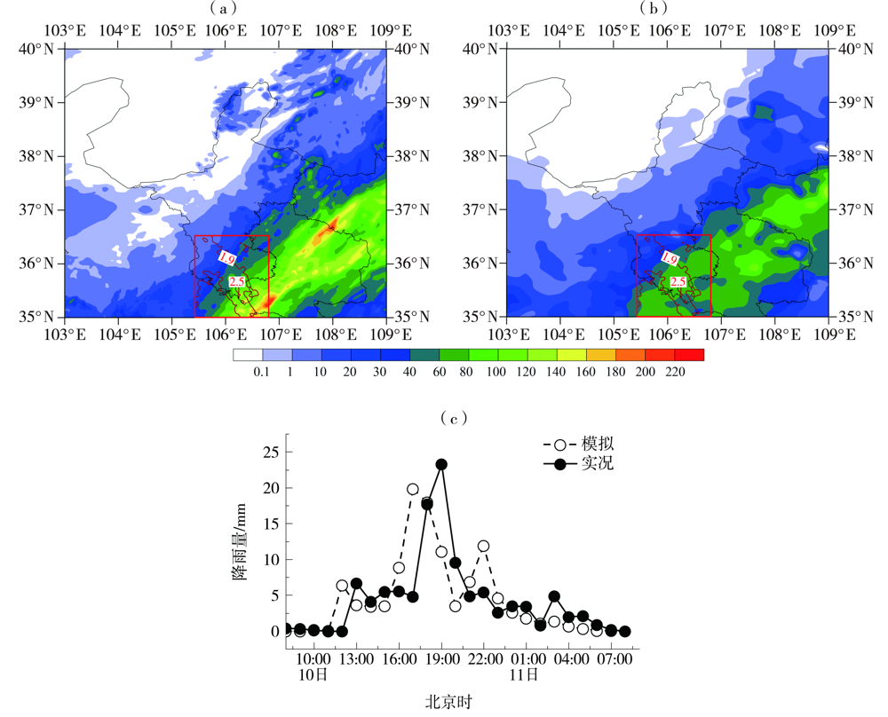
图3 2018年7月10日08:00至11日08:00模拟(a)与实况(b)24 h累计降水量(单位:mm)分布和
黄花乡站观测与模拟的逐小时降水量(c)
[红色方框为六盘山地形高度修改区域,棕色实线为海拔高度等值线(单位:km)。下同]
|
Fig.3 The distribution of simulated (a) and observed (b) 24 h accumulated precipitation (Unit: mm), simulated and observed hourly precipitation at Huanghuaxiang station (c) from 08:00 BST 10 to 08:00 BST 11 July 2018
(The red box is the modified topographic height area of the Liupan Mountain, the brown solid line is the elevation contour (Unit: km). the same as below)
|
|
|
|
|