一次典型东风波极端暴雨的中尺度特征及地形影响分析
|
|
胡振菊, 黎璐, 黄小玉, 何炳文, 叶日新
|
Analysis of mechanism of topographic influence and meso-scale convective characteristics of an extremely severe rainfall affected by typical easterly wave
|
|
HU Zhenju, LI Lu, HUANG Xiaoyu, HE Binwen, YE Rixin
|
|
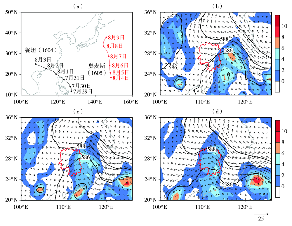
图2 2016年7月29日至8月9日1604和1605号台风路径(a),2016年8月10日08:00(b)、14:00(c)、11日02:00(d)500 hPa位势高度场(等值线,单位:dagpm)、850 hPa涡度场(阴影,单位:10-5 s-1)及风场(箭矢,单位:m·s-1)
(红色线包围区域为湖南省,下同)
|
Fig.2 The tracks of the typhon 1604 and 1605 from 29 July to 9 August 2016 (a), the geopotential height field (the isolines, Unit: dagpm) on 500 hPa, vorticity field (the shaded, Unit: 10-5 s-1) and wind field (the vectors, Unit: m·s-1) on 850 hPa at 08:00 BST 10 (b), 14:00 BST 10 (c) and 02:00 BST 11 (d) August 2016
(the area in the red border for Hunan Province, the same as below)
|
|
|
|
|